Saint-Malo
All the Light We Cannot SeeSaint-Malo is a walled port city on a granite headland whose sea boundaries, narrow connections to the mainland, and long history of sieges make it both a refuge and a military target. During the German occupation and the siege of August 1944, the city’s streets, ramparts, and underground defenses become the setting for civilian life under threat, the destruction of bombardment, and the eventual Allied liberation. Its physical layout also structures Marie-Laure LeBlanc’s experience of the city: she learns it through a miniature model and, later, by navigating its streets independently.
Setting and Physical Layout
Water surrounds Saint-Malo on four sides, while a causeway, a bridge, and a spit of sand provide its limited links to the rest of France. The old city stands within medieval walls on a granite headland. Its ramparts overlook the sea, and the tide reaches into basements at the center of town at its highest; at low tide, shipwreck remains appear offshore. The city’s position gives it a distinct boundary between land and sea, but also leaves its approaches exposed and strategically important.
The built environment is compact and densely marked by recognizable structures. Within the walls are the cathedral, the old Château de Saint-Malo, rows of houses and hotels, public squares, the seafood market, and the beach at Plage du Môle. Four ceremonial cannons stand above an opening in the ramparts at the Bastion de la Hollande. These are not just landmarks in a cityscape: for Marie-Laure, their arrangement becomes a usable map. At Number 4 rue Vauborel, she traces the model’s miniature parapet with her fingers and follows its stairways and streets, learning the geography by touch.
Saint-Malo’s isolation also gives it a history of conflict. The account notes that the promontory has experienced sieges for three thousand years. In 1944, rumors describe the German defenses as extensive: underground corridors beneath the medieval walls, an underground hospital, a large water tank, pillboxes, escape routes, and stockpiled ammunition. These reports circulate as whispers among inhabitants, including uncertain claims about the number of German troops. Even as rumor, they convey the scale of the threat residents believe surrounds them.
Occupation and Civilian Life
German forces enter the city in a procession observed by residents from behind shuttered windows. Motorcycles and trucks arrive, followed by a black Mercedes carrying a field captain. The mayor waits outside the château as the German officers emerge; after the captain enters the building, an aide opens an upstairs window and raises a crimson flag over the rooftops. The ceremony makes occupation visible across the city, transforming a familiar landmark into a sign of new authority.
The occupation is also registered through ordinary commerce and domestic routines. Residents report German soldiers buying postcards, straw dolls, sweets, clothing, butter, cheese, and champagne. Their clean uniforms and apparently unused weapons contrast with the everyday transactions through which they take over the town’s shops and supplies. Meanwhile, the German authorities impose restrictions and strengthen defenses. After a German truck is destroyed elsewhere in France, police demand able-bodied men for labor on trenches, railway wagons, and invasion obstacles. Access to beaches and walkways atop the ramparts is restricted, while the coastline is fortified with wire and barriers.
Civilian responses are varied. As the bombing threat approaches, the remaining inhabitants include older people, the poor, religious communities, people who have delayed evacuation, and those who disbelieve or resist the danger. Some go to shelters; others pause to collect blankets, prayer books, or playing cards. At Number 4 rue Vauborel, people also maintain the routines of a household under occupation, while the ringing of the doorbell can prompt immediate fear that the attic transmitter or the women’s visits have been discovered. The city’s public danger repeatedly enters private rooms.
The City as a Map and a Home
Marie-Laure’s miniature of Saint-Malo reproduces the city in detail, from the cathedral and château to the jetty, market, benches, and individual streets. Because she is blind, the model offers a means of knowing a place whose larger form she cannot see. Its scale turns a bewildering city into a sequence she can explore with her hands and remember as a network of routes. The model does not remove the city’s dangers, but it gives her a practical way to locate herself within it.
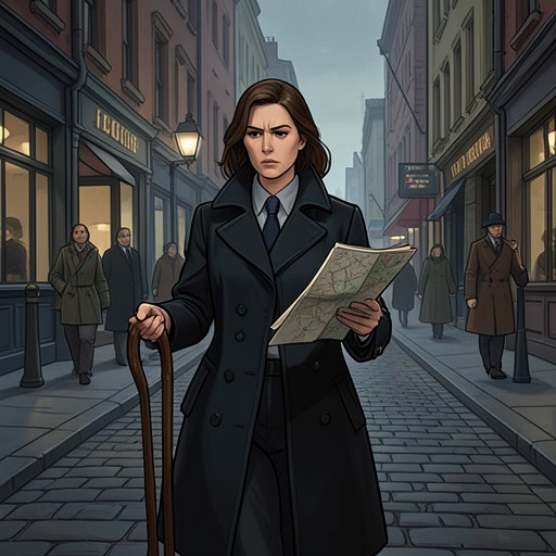
Her first arrival gives the same streets a different character. Her father carries her into the city and describes the portcullis, ramparts, granite houses, and steeple as they pass. The route feels to her like a maze leading toward an unknown interior. That contrast between explanation and uncertainty continues throughout her life in Saint-Malo: familiar routes can be learned, yet the city remains vulnerable to danger beyond her control. Later, she uses Harold Bazin’s iron key to reach the old kennel by the ramparts, a secluded place where she can spend time among her snails while the beaches are closed and mined.
Saint-Malo is also a place of family and community ties. Marie-Laure lives with her great-uncle, Etienne LeBlanc, and Madame Manec, whose care and daily presence sustain the household. After Madame Manec’s death, the continued movement of life in the city feels cruel to Marie-Laure: the house spider spins again, German sailors sing in the street, and the household must continue. The neighborhood’s shared routines and losses make the city more than a defensive position or a map; it is the setting in which people build relationships and endure their absence.
Siege and Destruction
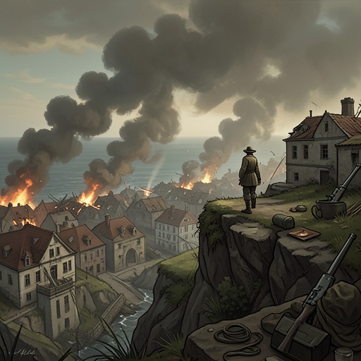
The siege reaches its decisive phase in August 1944. On 7 August, Marie-Laure wakes to the sound of large guns and finds Etienne absent from the house. On 8 August, bombing tears through the city. The buildings, roads, and harbor infrastructure are damaged, and a shattered jetty and a half-submerged fishing boat mark the destruction beyond the streets. After shelling pauses around six in the evening, the city is described through collapsed masonry, broken windows, damaged shop fronts, and fires still burning among the ruins.
The siege also places civilians in danger beyond the immediate bombardment. On its third afternoon, an American shell intended for another target strikes the northern parapet of Fort National, where 380 French prisoners are being held. Nine die in the explosion. The event shows how the city’s military position makes its inhabitants and prisoners vulnerable even to Allied fire. Elsewhere, German troops remain in blockhouses as buildings and trees burn, while residents shelter in cellars and other protected spaces.
During the destruction, the city’s scale and familiar landmarks remain vital to movement. After escaping the LeBlanc house, Werner Pfennig identifies streets and buildings amid rubble and smoke. Number 4 rue Vauborel still stands, its windows broken but its walls not badly scorched. When he later leads Marie-Laure out through the ruined streets, he chooses a direction based on the position of the American forces near Paramé. The city has become difficult to cross, but knowledge of its geography still matters: routes and landmarks help determine where the two can go.
Liberation and Aftermath
The American forces take the château and the last anti-aircraft battery, then free the prisoners at Fort National. Etienne LeBlanc is among those released; Madame Ruelle finds him in the processing queue, and he reunites with Marie-Laure. The German commander holding out in the underground fortress across the river resists for three more days. The siege ends after an American aircraft drops napalm through an air vent, after which a white sheet is raised. Clearance crews remove incendiary devices, and photographers enter the ruined city. Some residents return from farms, fields, and cellars, but the end of the siege does not instantly restore what the bombardment has destroyed.
On 25 August, Madame Ruelle is permitted to return to Saint-Malo to check on the bakery. Etienne and Marie-Laure instead travel to Rennes, where they find a hotel with a working boiler. Their departure marks a separation from the city that had sheltered them and shaped their daily lives. Later, the surviving Number 4 rue Vauborel is identifiable as the LeBlanc house, though it has been divided into holiday flats. Saint-Malo therefore remains both a real, altered place and the setting of memories that persist beyond the end of occupation.
Narrative Significance
Saint-Malo’s geography connects the novel’s intimate and military scales. The same walls that make the city legible in Marie-Laure’s model also define a fortified target; the same limited approaches that give the town a strong sense of enclosure shape the possibilities of arrival, escape, and rescue. Its repeated sieges make the 1944 destruction part of a longer history, while the particular streets and buildings keep that history grounded in individual experience.
The city’s changing condition also gives physical form to the novel’s contrasts between shelter and exposure, familiarity and uncertainty, and survival and loss. Before the siege, its landmarks can be learned, visited, and incorporated into daily routines. Under bombardment, those landmarks are damaged but remain points of orientation. After liberation, they cannot return the household to its former life, yet the surviving city continues to connect separated people with their past. Saint-Malo is thus both a strategic place in the war and a lived environment whose meanings depend on the people who move through it.