Lubango
Another Day of LifeLubango, formerly Sá da Bandeira, is a city in southern Angola and the headquarters of the southern front staff in the account. Its wartime importance rests on a stark imbalance: the city is described as being in MPLA hands, yet the countryside around it is held by the enemy, and the road linking it to isolated positions can become a trap. Lubango is therefore both a center of command and a fragile point in a region where movement, supplies, and control are uncertain.
City and Regional Setting
The narrative places Lubango 350 kilometres south of Benguela. From the air, the route passes over desert and green hills before reaching the city amid the broader piedmont landscape. This contrast establishes Lubango as a recognizable settlement within a southern region where the road and the surrounding terrain shape the possibilities of travel.
The 1970 census cited in the book gives Lubango a population of 32,000, placing it among Angola’s principal cities, though far below Luanda, which had approximately half a million inhabitants. The city’s former name, Sá da Bandeira, also locates it within the history of Portuguese rule. In the account’s brief historical outline, the southern province of Huíla, whose capital was Lubango, was occupied by Afrikaners until 1928. That history precedes the city’s later role as a front headquarters, but both connect it to the changing political control of southern Angola.
A Southern-Front Headquarters
During the war, Lubango served as the headquarters of the southern front staff. Its strategic position did not mean that the MPLA could freely command the surrounding territory. A report given to the narrator describes Lubango and Pereira d’Eça as being in MPLA hands, while the enemy held the countryside and the road between them. The distinction between holding a city and controlling the land around it is central: a town could remain under one side’s authority while travel to it or through its hinterland remained dangerous.
The scale of the southern front made that vulnerability concrete. Comandante Farrusco’s unit numbered 120 and was described as the only unit in a region stretching 450 kilometres between Lubango and the border, and 1,200 kilometres between the Atlantic and Zambia. The area was said to be one-third the size of Poland. In such a vast sector, the road toward Lubango was not simply a route among several. It was the necessary corridor for retreat and reinforcement, and the limited transport available could not carry the entire unit on foot or move everyone at once. The possibility that enemy forces might cut the road turned distance into a military constraint.
Routes, Supplies, and Isolation
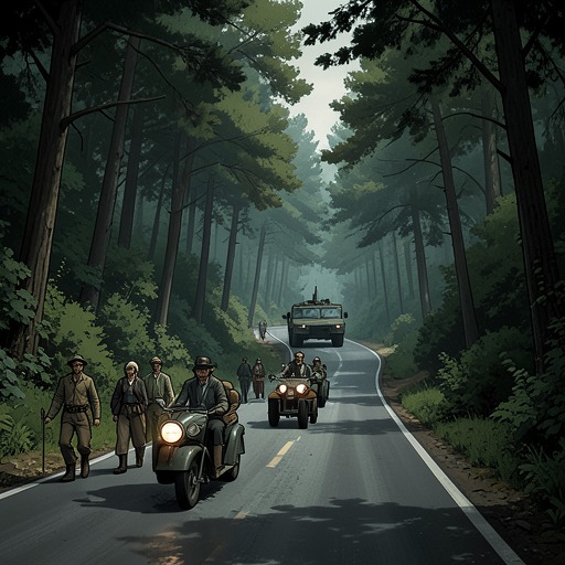
The road system around Lubango appears less as reliable infrastructure than as a source of exposure. A convoy travelling toward Pereira d’Eça was warned that no convoy had reached the unit there for a month and that trucks had been lost in ambushes. The force set out in an old, overloaded Mercedes carrying rifles, ammunition, gasoline, flour, and six soldiers in the back. The vehicle could travel no faster than 60 kilometres per hour. Its condition and load left the party with little room to evade danger, while the long route offered few alternatives.
The remains of burned-out trucks along the road showed what had happened to earlier convoys. The account emphasizes the practical bind: leaving the road risked death from thirst in a waterless landscape, while staying on it risked an ambush. Diogenes argued that the heat around midday could make travel safer because combatants withdrew into the shade, and the convoy continued under that calculation. The route was thus governed not only by military positions but by the availability of water, the state of vehicles, the time of day, and the chance that the enemy might occupy the road.
A staff map at Pereira d’Eça makes Lubango’s place in this network visible. A tack marked the isolated unit at Pereira d’Eça; farther north, other tacks marked Lubango, Mocçâmedes, and Matala. A thick, broken line represented the road, while the map’s symbols also recorded the border, bush, desert, and casualties. The sparse markers around Pereira d’Eça contrasted with the more numerous ones farther north. Lubango appears in this geography as a significant point of connection, but not as a guarantee that the connection could be maintained.
The Evacuation Flight and the City’s Exposure
Lubango enters the narrative during an improvised flight to collect the last group of Portuguese refugees. A two-engine Friendship aircraft, flown by exhausted Portuguese pilots, was preparing to fly from Benguela to Lubango. The narrator had no pass for the southern front, which was described as the weakest, most neglected, poorly organized, and poorly armed front. He nevertheless boarded the aircraft without permission, intending to continue the journey rather than remain behind.
At Lubango’s airport, Portuguese refugees waited with suitcases and kit bags, accompanied by wives and children. They hurried toward the plane before its engines had even stopped. A local man agreed to take the narrator to the staff headquarters, but warned that the aircraft was the last one leaving. In his assessment, the town was in MPLA hands but surrounded, and the road into town might be controlled by the enemy by the following day. The scene makes air transport an uncertain escape route, not a dependable connection: the flight could bring people out, but its departure might also leave those remaining with no safe way onward.
The staff headquarters occupied a residential quarter on a hill. There the young political commissar Nelson greeted the narrator warmly, then immediately issued him a pass to go to the front. A truck was already being loaded with weapons, ammunition, gasoline, and flour for the journey. The episode ties the city’s administrative role to the needs of the front: orders and passes originated there, while supplies had to be carried outward along a road exposed to attack.
The City After the Invasion
Lubango’s later appearance in the book comes through the uncertain fate of people associated with the southern front. When the last South African army units withdrew from Angolan territory on 27 March 1976, they returned along the road the narrator had travelled with Diogenes and Comandante Farrusco. Farrusco had been hidden in Lubango during the invasion and remained there for a long time; his wounds eventually healed. The account does not establish what happened to Diogenes, while Antonio and Carlos were reported killed. With the withdrawal, the narrative records calm on all fronts.
That ending gives Lubango a role beyond headquarters or waypoint. It is also a place of concealment and survival during the invasion, though the account leaves the fates of several people unresolved. Across the episodes, the city’s significance is measured by what it can connect and what can be cut off: refugees depend on the last aircraft, front units depend on a vulnerable road, and a person endangered by the invasion can find refuge there. Lubango remains a center in the map of the war, but never a secure one.