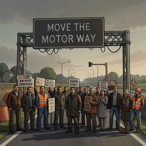
Knocknaree Land-Development Investigation
In the WoodsSam O'Neill’s investigation into land around Knocknaree turns a sprawling map into a record of how a planned motorway could generate private fortunes. By tracing ownership, failed rezoning applications, and the sharply different values of land near alternative routes, Sam identifies a possible financial motive behind pressure to preserve the proposed alignment. His findings illuminate a suspected development scheme, but they do not prove that the land dealings caused the crimes the detectives are investigating.
Building the Investigation
While Cassie Maddox and Rob Ryan repeatedly reviewed door-to-door reports from the floaters, Sam spent much of his time away from the office interviewing county council members, surveyors, farmers, and members of the Move the Motorway campaign. He offered few details at their dinners, saying only that his findings would become clearer in a few days. His notes, which Rob glimpsed briefly, consisted of diagrams, shorthand, and small sketches: careful work whose meaning was not yet apparent to the rest of the team.
On a muggy, drizzly Tuesday morning, Sam brought a large roll of paper into the incident room and taped it to the wall. The detailed map depicted Knocknaree’s houses, hills, river, wood, and keep in fine pen and ink. Irregular sections of land had been shaded in different colors, with abbreviations and names written inside them. The map made visible what Sam had been pursuing through interviews and ownership records: not simply where the motorway would run, but who owned the land around it and how that ownership had changed.
The Route and the Ownership Trail
Sam marked the planned motorway as two parallel dashed lines cutting across the wood and the archaeological dig. The government announced the plans in March 2000, and over the following year land was bought from local farmers under a compulsory purchase order. He initially distinguished these compulsory purchases from the suspicious part of his inquiry: the ownership behind them. Numerous apparent buyers were holding companies, nested within other companies, making the actual owners difficult to identify.
By following the purchases through those layers, Sam traced the land to three companies: Global Irish Industries, Futura Property Consultants, and Dynamo Development. On the map, blue represented Global, green Futura, and red Dynamo. Two of the companies were registered in the Czech Republic and Futura in Hungary. Sam could not yet identify the people behind them. The corporate structure and foreign registrations raised suspicions, but he cautioned that the arrangement might amount to tax evasion and that he could not see how it necessarily connected to the detectives’ case. His distinction between what looked dubious and what could be proved remained central to the investigation.
The Farmers and the Rezoning Pattern
The map also recorded four farmers who had resisted selling their land and were later traced to Louth. They had noticed that buyers were offering prices above the ordinary agricultural rate, discussed the offers among themselves, and held on while trying to understand the interest in their property. When the motorway plans became public, the potential value of land near the route became clearer: improved access could make it attractive for industrial estates and residential development. The farmers sought rezoning themselves, hoping to benefit from the increase in value, but the county council refused their applications each time.
Sam’s notes gave that pattern a specific chronology. One farmer, Maurice Cleary, had rezoning applications refused in May and November 2000, then in June 2001 and January 2002. The record also noted a later sale to Futura Property Consultants. The farmers eventually sold for prices that were good by agricultural standards but far below the value of land zoned for industrial or residential use. Cleary, who wanted to remain on his farm, was visited by a representative of a holding company. The representative said that a pharmaceutical plant would be built beside the farm and that chemical waste might seep into the water and poison the cattle. Cleary took the warning as a threat, though Sam could not establish whether that interpretation was correct, and sold.
After the Big Three had acquired the land, using various names that Sam said could be traced back to them, they applied for rezoning and received approvals. The contrast was significant: the farmers’ applications had been rejected repeatedly, while the companies’ applications succeeded after the land had passed into their hands. Sam suspected that the companies had influence over the county council, but suspicion was not proof. Council representatives had answered his questions with general statements about serving the community and denying favoritism, rather than providing a direct account of the decisions.
The Financial Stakes and the Recording
Sam’s route comparisons supplied a possible reason for the companies to care intensely about the motorway’s alignment. Surveyors identified a plausible alternative route roughly two miles from the planned one, and four or five miles away in some places; it was also the route favored by the Move the Motorway campaign. Land north of the original route would remain reasonably accessible, but the companies also held substantial land to the south. Estate agents told Sam, when he posed as a prospective buyer, that industrial land directly beside a motorway could be worth as much as twice the value of industrial land three miles away. He had not completed the calculations, but the difference could amount to millions.
That potential loss gave the land map a sharper implication. If the motorway moved, the value of some holdings could fall substantially; if it stayed, the companies could benefit from the access and the successful rezoning. Sam observed that the companies had invested heavily in the land and would be unlikely to welcome a change of route. Cassie Maddox connected the possible financial stakes with threatening phone calls, while Rob Ryan noted that such stakes might make violence seem worth paying for. Those comments framed a possible motive, not a demonstrated link between the developers and a hired killer.
Later, Sam and Rob listened to a recording of Terence Andrews in an angry exchange with another speaker. Andrews complained that promised progress had not materialized, pointed to injunctions obstructing the plans, and referred to having paid thousands of pounds, including money for a councilor. His counterpart insisted that matters remained under control. The recording suggested that payments and political influence might lie behind the stalled development, giving more weight to the suspicions raised by Sam’s map. It did not, on the evidence presented, identify every recipient or establish precisely how the exchange connected to the companies and the crimes.
Significance and Limits
Sam’s investigation changes the scale of the detectives’ inquiry. The map connects land purchases, opaque corporate ownership, rezoning decisions, motorway access, and possible payments into a single economic pattern. Its force comes from the accumulation of specific transactions and disparities: farmers unable to secure rezoning, companies later obtaining it, and land whose value depended heavily on proximity to the planned road.
At the same time, Sam repeatedly marks the boundary between a compelling pattern and a provable conclusion. He cannot establish whether the warning to Cleary was intended as a threat, who ultimately stood behind every holding company, or whether the apparent influence over council decisions constituted corruption. Nor does the recording alone prove that the suspected development interests ordered or caused violence. The investigation therefore supplies the case with a plausible financial context and a set of leads, while leaving the final connection between development, intimidation, and murder unresolved.