Proposed Knocknaree motorway
In the WoodsThe Proposed Knocknaree motorway is more than a line across a map: it is the prospect around which land in Knocknaree was bought, rezoned, and made newly valuable. Its route cuts through the wood and the archaeological dig, linking a public infrastructure plan to private development interests and to the investigation’s inquiry into threatening calls. The evidence does not establish that the motorway itself explains the murder, but it does show how the route reshapes the stakes surrounding the site and the land around it.
Route and planning
Sam O’Neill’s map traces the planned motorway with two parallel dashed lines curving across the wood and the dig. The government announced the plans in March 2000, then bought land from local farmers over the following year under compulsory purchase orders. Sam distinguishes these public acquisitions from the more revealing activity on the surrounding land: the motorway’s footprint was only part of the story.
That surrounding farmland began changing hands in late 1995. Over the next four years, parcels were bought and rezoned from agricultural use to industrial and residential use, before the route had been publicly announced. Sam finds a plausible explanation for the timing rather than proof of supernatural foresight: discussion of a motorway approaching Dublin from the southwest had appeared in newspapers around 1994, and surveyors considered the eventual route the most obvious option given local topography and settlement patterns. Developers could therefore have anticipated the corridor and purchased strategically.
By the time the government announced the plans, three companies owned almost all the land around that section of the route. Four farmers had held on to their parcels, partly because the buyers were offering above the agricultural rate and the farmers wanted to understand what was happening. Once the motorway was announced, the prospect of industrial estates and housing made the land’s potential value clear. The four applied to the county council for rezoning, but their applications were repeatedly refused; one farmer, Maurice Cleary, applied four times.
Acquisition and rezoning
The farmers ultimately sold for prices attractive by agricultural standards but well below what industrial or residential land could command. In Cleary’s case, a representative of a holding company reportedly warned that a pharmaceutical plant beside his farm could bring chemical waste into the water and poison his cattle. Sam does not know whether Cleary’s interpretation of the visit as a threat was correct, but he says Cleary sold. After the three companies acquired the remaining land, using other names that Sam says could be traced back to them, they applied for rezoning and obtained it.
The contrast is central to the land scheme Sam describes: the farmers’ applications failed, while the companies’ applications succeeded after their purchases. A council representative offered Sam a carefully qualified assurance that decisions had served the community and were not affected by favoritism, but the explanation did not resolve his suspicions. The map and the sequence of decisions instead make visible how control of land, planning decisions, and the expected route converged. The evidence suggests a pattern of advantage; it does not independently prove who influenced the council or how.
Competing routes and financial stakes
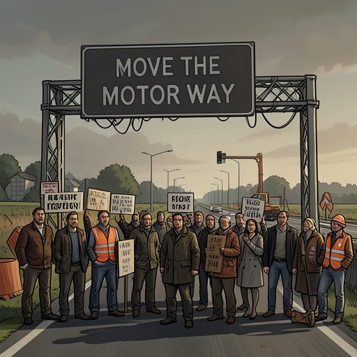
The motorway’s exact alignment mattered because a move could redistribute the value created by public infrastructure. Sam’s surveyors identified a nearby alternative route, the one supported by the Move the Motorway campaign. It would lie about two miles from the original corridor, and four or five miles away in some places. Land north of the proposed route would remain reasonably accessible, but the companies also held substantial land to the south, whose value would fall if the motorway shifted away.
Sam’s conversations with estate agents gave the comparison a concrete scale: industrial land beside the motorway could be worth as much as twice the value of industrial land three miles away. He had not calculated the full difference, but estimated that it could amount to millions. The campaign to move the route was therefore not simply a disagreement over where a road should go. A different alignment would change which landowners benefited most from proximity to it, and could undermine the value of the companies’ accumulated holdings.
The threat-call inquiry brings that economic pressure into the police investigation, without establishing that any particular call was caused by the motorway dispute. Sam’s map gives the team a reason to consider who stood to lose if the route changed. In a later recording of Terry Andrews, Andrews complains that injunctions are obstructing progress and refers to thousands of pounds paid, including money for a councilor. The exchange supports the existence of a costly and contentious dispute around the project; it does not, by itself, identify the purpose of every payment or prove a connection to the murder.
Public story and local history
The project had attracted public criticism before Sam assembled his map. In 2000, journalist Michael Kiely wrote that the motorway had already achieved a primary purpose by making property developers happy. He told Sam that he had been ordered off the story almost as soon as it began, supposedly for legal reasons, though Kiely believed the decision was personal. His account is presented as an allegation, not a demonstrated explanation for the project or for the newspaper’s silence.
Kiely also connected the wider development history to Knocknaree estate. He recalled rhetoric about creating a new urban hub, followed by the claim that the budget would not support further development once the houses in the estate had been sold. He suspected that the promised future had helped secure higher sale prices, but acknowledged that he had no proof. He further said that injuries and fatalities during construction had occurred at nearly three times the national average and wondered whether a place might resist human mismanagement. His speculation gives the site an uncanny dimension, but Rob Ryan rejects it as an explanation for Katy Devlin’s killing.
The route also became part of the public framing of the murder. Reporters linked the ceremonial stone at the archaeological site to ancient human sacrifice and asked whether Katy’s death involved a religious cult. The police said there was no evidence for that claim. Such coverage placed the murder, the site’s past, and the proposed road in the same public conversation, but the cult speculation did not constitute evidence about either the killer or the land dealings.
Significance and limits
The Proposed Knocknaree motorway connects planning decisions to private expectations of profit: farmland bought before the announcement became more valuable when the route was confirmed, while rezoning determined which owners could develop it. The possibility of a reroute threatened to reverse some of those gains. This makes the motorway an important background to the threatening-call investigation and to the conflict over Knocknaree’s future, while keeping the distinction between financial motive and proven criminal responsibility intact.
Its presence is also spatially consequential. The marked route crosses both the wood and the dig, places at the center of the novel’s histories and investigation. But the evidence here establishes the planned alignment and the surrounding land transactions, not the eventual construction outcome or the full extent of damage to the archaeological site. The road’s importance lies in the pressure it creates before those outcomes are settled: the map shows a public project crossing a landscape that has already become an object of private calculation.