Sam’s map of land ownership and zoning in Knocknaree
In the WoodsSam’s map of land ownership and zoning in Knocknaree is both a painstaking piece of cartography and an investigative argument. By placing the proposed motorway, the surrounding properties, and successive changes in ownership on one sheet, it gives the Murder squad a way to see how infrastructure planning might create private gains. Yet its precise rendering of the landscape makes the investigation’s financial abstractions inseparable from the wood and archaeological site they threaten to alter.
Making the Map
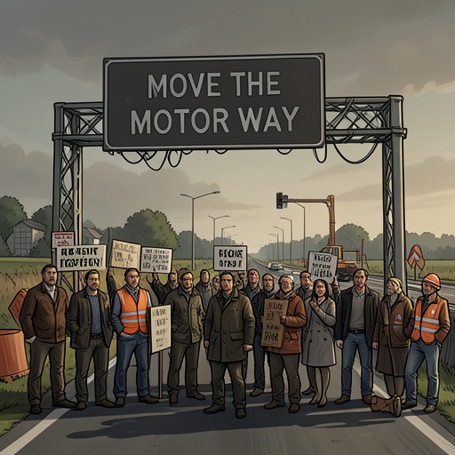
Sam assembled the map after spending much of his time outside the office interviewing county council members, surveyors, farmers, and members of the Move the Motorway campaign. He kept the purpose of this work vague at the team’s dinners, promising to explain when the material began to make sense. His notes were crowded with diagrams, shorthand, and small sketches: careful records that were difficult for his colleagues to decipher until he put them together.
On a drizzly Tuesday morning, while Rob Ryan and Cassie Maddox were reviewing door-to-door reports, Sam brought a large roll of paper into the incident room and taped it to the wall. The finished map was a detailed rendering of Knocknaree, with its houses, hills, river, wood, and keep drawn in fine pen and ink. It was large enough for the detectives to leave their reports and gather around it. Its irregular colored blocks and tiny annotations translated Sam’s dispersed interviews and research into a single visual field.
The map’s annotations were not decorative. Abbreviations recorded ownership and planning history in miniature, including purchases and rezoning applications. Its colors distinguished the three companies Sam had traced through layers of holding companies: blue for Global Irish Industries, green for Futura Property Consultants, and red for Dynamo Development. Yellow marked the four farmers who had initially held on to their land. The visual key made it possible to compare the broad distribution of property with the particular histories hidden in the notes.
Routes, Ownership, and Rezoning
Two parallel dashed lines showed the proposed motorway route, cutting across the wood and the archaeological dig. Sam explained that the government had announced the plans in March 2000 and that land was bought from local farmers over the following year under compulsory purchase orders. By the time of the announcement, he said, the three companies already owned almost all the land around that section of the route. His map therefore posed a question about timing and advantage, without itself establishing that the purchases were improper.
Sam’s work followed ownership through multiple corporate layers. The companies he identified were ultimately connected to Global Irish Industries, Futura Property Consultants, and Dynamo Development, although he had not established who stood behind them. Two of the companies were registered in the Czech Republic and Futura in Hungary. Sam considered tax evasion a likely explanation for the opaque arrangements and said the information could be passed to the Revenue; at that point, he did not regard it as demonstrably connected to the murder investigation.
The yellow parcels gave the map a more specific chronology. Four farmers, now living in Louth, had resisted selling when the other owners accepted offers above the going rate for agricultural land. They expected the motorway to make the area more accessible and hoped to have their own land rezoned for industrial or residential development. The county council rejected their applications. One farmer, Maurice Cleary, applied four times; the map’s marginal notes list refusals in May and November 2000, June 2001, and January 2002.
The map also recorded how resistance ended. Cleary wanted to remain on his farm, but a representative of a holding company warned him that a proposed pharmaceutical plant might allow chemical waste to seep into the water and poison his cattle. He understood the warning as a threat, though Sam could not establish whether that interpretation was correct. Cleary eventually sold, in August 2002, for roughly the same agricultural price as the other farmers rather than the higher value he hoped rezoning would bring. Once the larger companies had acquired the land under various names, their own rezoning applications succeeded. The map makes the contrast visible: rejected applications by individual farmers, followed by approval after the land passed into the companies’ hands.
The Alternative Route and the Stakes
A second pair of dotted lines marked what Sam’s surveyors considered the nearest logical alternative: a route favored by the Move the Motorway campaign, about two miles from the proposed alignment and four or five miles away in some places. The map showed that land north of this alternative would remain reasonably accessible, while holdings south of it would lose value. Sam had also asked estate agents about industrial land prices, posing as a prospective buyer. They told him that industrial land beside the motorway could be worth up to twice as much as comparable land three miles away. He had not calculated the precise total, but estimated that the difference could run to millions.
These comparisons supplied a possible economic context for the threat calls under investigation. Sam reasoned that the companies had substantial investments tied to the original route and would have had reason to oppose moving the motorway. Later, a recording of a conversation involving Terry Andrews captured complaints about injunctions, money already paid, and further payments associated with a councilor. That material adds a concrete financial dimension to the investigation, but it does not make the map proof of who arranged the calls or establish a direct connection between every transaction and the case. Its value lies in assembling a pattern of interests and stakes that the detectives can test against other evidence.
The Map as an Object in the Room
The map remained taped to the incident-room wall after Sam explained it. Rob found it irritating for reasons he could not fully identify, and connected that reaction to the drawing’s delicate perfection: tiny leaves curled through the wood, and small, uneven stones were picked out in the wall of the keep. Its charm unsettled him because it made the place feel closely particular, not like interchangeable land on a development plan. He found himself imagining two tiny laughing faces slipping out of sight among the drawn trees, an image that joined the map’s painstaking order to the wood’s uncanny presence.
Cassie Maddox altered the picture by drawing a property developer with a suit, horns, and dripping fangs in one of the yellow areas. The deliberately childish caricature did not add evidence to Sam’s investigation, but it gave visible form to the anger the map’s history had stirred. Rob jumped whenever he caught sight of it in the corner of his eye. The map thus gathered two kinds of response in the same space: a detective’s attempt to make ownership and planning legible, and the team’s uneasy awareness that the landscape being divided into parcels was also a place marked by memory and loss.