Île de la Cité
The Hunchback of Notre DameÎle de la Cité is the cradle of medieval Paris: first its bounded core, then the river-crossing center that joined the expanding City to the Town and University. Its bridges and streets made the island a point of passage, while its quays, cloister grounds, and concealed shoreline also offered routes into and out of the city’s most dangerous scenes.
The Island at the City’s Beginning
Paris first occupied Île de la Cité, whose strand served as its earliest boundary wall and the Seine as its moat. The island’s two bridges were guarded by the Grand Châtelet on the right bank and the Petit Châtelet on the left, each functioning as both a gate and a fortress. As the settlement outgrew its island, it crossed the river and spread outward; successive walls were overtaken by houses, and the original island boundary became a memory rather than the edge of the city.
The island was part of a wider archipelago. In the fifteenth century, the Seine enclosed five islands within Paris: Île de la Cité, Louviers, the deserted Île aux Vaches and Île Notre-Dame, and a small islet at the tip of the City. The last was later engulfed beneath the platform of the Pont-Neuf. Île aux Vaches and Île Notre-Dame, both then nearly unbuilt, were joined in the seventeenth century and developed as Île Saint-Louis. The changing outline of the river islands records Paris’s expansion as concretely as its changing walls.
Bridges and the Three-Part City
In 1482, the City, Town, and University remained distinct urban districts, but the Seine and the bridges continually connected them. Île de la Cité had five bridges: the stone Pont Notre-Dame and Pont au Change on the right-bank side, the wooden Pont aux Meuniers, and the Petit Pont and wooden Pont Saint-Michel on the left-bank side. Houses crowded the bridges, making them inhabited extensions of the streets rather than empty crossings.
Two major routes ran through all three districts, changing names as they crossed the island and the river. One connected the Porte Saint-Martin with the University quarter, the City, and the Town; within the City it was called the Rue de la Juiverie, and it crossed the water by the Petit Pont and Pont Notre-Dame. The other linked the Porte Saint-Michel to the Porte Saint-Denis, passing through the City as the Rue de la Barillerie and using the Pont Saint-Michel and Pont au Change. These were the city’s principal arteries: the Seine divided the districts, but the bridges repeatedly carried people across the division and made the three parts function as one body.
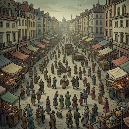
From the towers of Notre-Dame Cathedral, the island could be seen within a vast, tightly woven cityscape of roofs, streets, bridges, squares, spires, and bell towers. That elevated view contrasts with the experience at street level, where alleys could fold back on themselves and leave a traveler lost. Île de la Cité is therefore both a legible center in the city’s broad plan and a node within a dense urban maze.
Quays, Cloister, and Escape Routes
The island’s eastern end included the Terrain, a tongue of land belonging to the Chapter of Notre-Dame and enclosed by walls on the City side, behind the church. During the assault on Notre-Dame, the cloister courtyard and this point of land offered a way out from the church without crossing the besieged Parvis. The canons had fled to the bishop’s palace; the courtyard was nearly empty, and the man accompanying Gringoire opened the door to the Terrain with a key.
At the water’s edge, behind a trellis of posts and laths, a small boat had been hidden. The man brought Gringoire, Esmeralda, and Djali aboard, then cut the moorings and rowed toward midstream. The current was strong enough to make it difficult to leave the island’s point. This escape depends on intimate knowledge of the island’s edges: the church and cloister provide passage, a wall conceals the landing, and the river becomes both obstacle and route away from danger.
The same geography governs the approach to the church. From the Northern tower, Quasimodo watched movement along the Quay de la Vieille-Pelleterie and then saw a column of people emerge into the Rue du Parvis and spread across the square. His elevated position gave him a view of the island’s approaches, but his deafness left the approaching crowd silent to him. The quays and streets that connected Île de la Cité to the rest of Paris thus became the paths by which danger could reach its center.
Narrative Significance
Île de la Cité is not merely a setting between riverbanks. It is the hinge on which the novel’s Paris turns: an ancient refuge and center of authority, joined to the wider city by bridges, yet capable of being approached, surrounded, or escaped through specific passages. The contrast between the panoramic view from Notre-Dame Cathedral and the obscurity of the quays, alleys, and enclosed courts gives the island two scales at once. It is the central shape in a map of Paris and a close-grained landscape of thresholds, crossings, and hidden exits.