The Three-Part Division of Medieval Paris
The Hunchback of Notre DameThe Three-Part Division of Medieval Paris describes the city as three distinct urban communities—the City, the University, and the Town—whose different jurisdictions, institutions, and histories were bound together by streets, bridges, and the Seine. This arrangement makes Paris more than a collection of buildings: its geography organizes political authority, movement, privilege, and the experience of being lost within the city.
Three Cities in One
In the fifteenth century, the City occupied the island in the Seine. It was the oldest and smallest of the three divisions, and the source from which the other two had grown. The University occupied the left bank, while the larger Town spread across the right. Each had its own character, customs, privileges, and history. The City was associated particularly with churches, the Town with palaces, and the University with colleges. In the narrator’s comparison, the island-city seemed like an old woman caught between two larger, handsome neighbors: a compact image of both its antiquity and its diminished scale beside the districts that had grown around it.
Their boundaries had developed through the outward expansion of settlement. Paris began on the island, whose shore served as its first boundary and whose surrounding river formed a natural moat. For centuries the city remained concentrated there, entered by bridges guarded by the Grand Châtelet on the right bank and the Petit Châtelet on the left. As the island became too confined, settlement crossed the water. An early circuit of walls and towers pushed into the surrounding land; later, Philip Augustus enclosed the growing city with another ring of substantial towers. Houses accumulated inside this barrier, grew higher and denser, and eventually spilled beyond it into the plain. The city’s divisions thus belonged to a history of successive containment and expansion, not to a static plan.
Jurisdictions and Privileges
The three divisions were not merely recognizable neighborhoods; they belonged to overlapping systems of authority. The island was under the bishop, the right bank under the provost of the merchants, and the left bank under the Rector. Above these local powers stood the provost of Paris, a royal official rather than a municipal one. The distribution of major institutions reinforced the distinctions: Notre-Dame Cathedral belonged to the City’s civic landscape, while the Louvre and Hôtel de Ville marked the Town, and the Sorbonne the University. Markets, the hospital, and the Pré-aux-Clercs likewise belonged to different parts of the urban fabric.
That division could make legal responsibility difficult to locate. Scholars accused of offenses on the left bank might be tried in courts on the island and punished on the right bank at Montfaucon, unless the Rector intervened under the University’s privileges. The account underscores that these privileges were not simply bestowed: many had been won from kings through revolts and mutinies. Authority was therefore distributed across ecclesiastical, royal, urban, and academic institutions, and those institutions could compete over judgment and enforcement.
The conflicts surface beyond this institutional overview. The outcasts of the Cour des Miracles complain that the bailiff, whose vassals they are, claims authority over them as judge and highway officer; they resist recognizing him in either role. Their grievance shows how lordship and municipal administration could meet in contested space. The city’s divisions were not just lines on a map: they shaped who could claim jurisdiction over a person or community, and whose authority might be refused.
Walls, Water, and the Street Plan
The Seine both separated and connected the three districts. Paris contained five islands within its walls, among them the City and several smaller islands that were then sparsely occupied or wooded. The City itself had five bridges: three to the right bank, including the stone Pont Notre-Dame and Pont au Change and the wooden Pont aux Meuniers; and two to the left, the stone Petit Pont and wooden Pont Saint-Michel. These crossings carried movement across the river while remaining part of a landscape thick with houses and defenses.
Walls and gates gave each bank a more particular outline. The University had six gates built by Philip Augustus; the Town had six built by Charles V. A deep moat supplied by the Seine ran around the walls, and at night the gates closed while large iron chains barred the river at both ends of the city. Such defenses protected Paris, but they also made its divisions tangible: crossing from one district to another meant passing through a network of bridges, gates, and controlled approaches.
Within those boundaries, the street plan combined a tangled appearance with a recognizable underlying structure. Two principal routes crossed the whole breadth of Paris, passing through all three divisions under different names. One extended from the Porte Saint-Martin through the University, City, and Town, crossing the river by the Petit Pont and Pont Notre-Dame. The other ran from the Porte Saint-Michel toward the Porte Saint-Denis, with its sections and crossings named differently in each district. Alongside these cross-city arteries, the City and University each had a major street running lengthwise, parallel to the Seine. These routes formed a framework; around them clustered narrower, interconnected streets that spread from bridges toward the gates.
The City Seen and Experienced
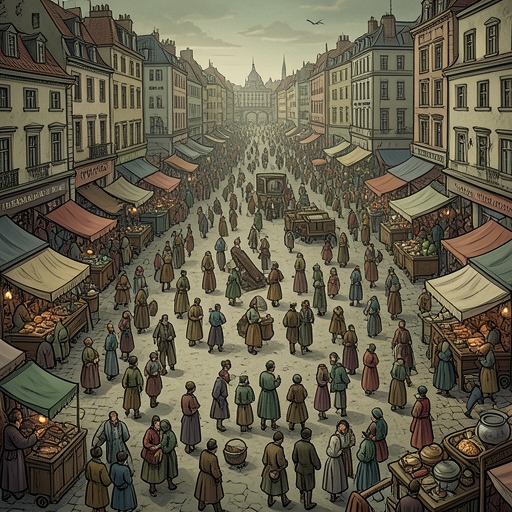
From the towers of Notre-Dame Cathedral in 1482, the city first appeared as a confusing mass of roofs, chimneys, streets, bridges, squares, spires, and bell towers. Its buildings differed in age, scale, material, and form, from modest carved houses to the royal Louvre. Seen from above, the three divisions could be perceived as an intricate whole, but that unity did not erase their separate jurisdictions or urban identities. The panoramic view reveals the system that a person moving at street level could not easily grasp.
Pierre Gringoire’s nighttime pursuit of Esmeralda gives that difficulty a local, bodily scale without dissolving the larger map. After the curfew, the streets around the Saints-Innocents burial ground grow dark and deserted. Gringoire loses his way among alleys, squares, and closed courts that repeatedly turn back upon themselves, while Esmeralda follows a route that appears familiar to her. He identifies his position only when he catches sight of the fish-market pillory. The episode contrasts the city’s legible principal arteries with the disorienting paths that branch between them: knowledge of the city depends on a person’s route, landmarks, and familiarity with the district.
The same urban geography structures refuge and punishment. Churches and other privileged sites could offer asylum, making them islands of protection amid competing jurisdictions. Yet sanctuary depended on remaining within its bounds; leaving it could return a fugitive to the reach of the authorities. In Esmeralda’s sentence, officials specify a route from the portal of Notre-Dame Cathedral to the Place de Grève, linking a religious threshold to a civic place of punishment. These settings show how the divided city could shelter, constrain, and expose people through the jurisdictions attached to particular places.
Significance
The Three-Part Division of Medieval Paris presents urban space as an active framework for social and political life. The City, University, and Town are distinct enough to sustain separate authorities and identities, yet the river crossings and principal streets continually carry people between them. Their arrangement produces neither a simple unity nor a clean separation: Paris is a connected body made from competing parts.
That tension also shapes the narrative’s treatment of the city. A view from Notre-Dame’s towers reveals a coherent pattern across the roofs, while a pedestrian’s passage through the alleys can become a maze. Walls, gates, courts, bridges, and sanctuaries give movement consequences; they determine where authority applies, where refuge is possible, and how a person might be pursued or lost. The city’s plan is therefore not only descriptive background but a record of accumulated political history and a practical force in the lives staged within it.