Montauk
The SwarmMontauk is the eastern Long Island setting of a coastal emergency that changes scale in a matter of moments: a reported accident at sea becomes an invasion advancing from the water across the beach and toward the town. The location’s importance lies in that crossing. Montauk first appears as a place where reports are uncertain and distant; it then becomes the ground from which the ocean’s threat can be seen, escaped, and tracked along the coast.
Setting and coastal context
The novel situates Montauk within the resort landscape of Long Island. The region’s beaches and fish restaurants draw holidaymakers, while East Hampton and Southampton are described as expensive communities associated with wealth. Darryl and Linda Hooper are spending their honeymoon on Long Island; their presence places the unfolding danger amid a familiar human use of the shore as a place of leisure rather than as a boundary under threat.
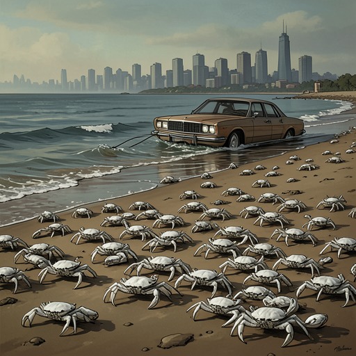
The physical geography gives the attack a clear route inland. Near Montauk, the eastern end of Long Island is a narrow strip of land, with a road running parallel to the coast. In the scene, the Hoopers are on rocks near a beach, separated from it by a wall of rock; from raised ground around a lighthouse, the advancing crabs can be seen across the beach and into the parking area. These are not merely picturesque details. Beach, bluff, parking lot, and road form successive points along which the danger becomes harder to avoid.
The event also sits within the book’s broader distinction between the familiar shallows and the less knowable ocean beyond them. Its account of continental shelves describes shallow water as the submerged continuation of land, while the depths beyond are framed as a world science has not mastered. Montauk’s crisis makes that conceptual boundary practical: the sea is not a distant backdrop, but the source of creatures moving into spaces people use and inhabit.
From uncertain report to visible emergency
Montauk first enters the crisis through a call relayed to an underground intelligence station at Buckley Field. A fishing boat has reportedly requested help near the north-east tip of Long Island, with an accident involving a sperm whale considered possible. The report is not treated as certain: amid widespread alarm, false calls are also reaching authorities, and the larger vessel said to be heading to the scene cannot be confirmed. Contact with the crew breaks off almost immediately.
The uncertainty shapes the first response. A KH-12 satellite is approaching Long Island from the south-east and is in a position to search the relevant coastline. The station is directed to focus its telescope there. Montauk is thus first established at a distance, as a point on a monitored coast and the suspected site of an incident that may or may not be genuine. That remote view contrasts with the experience on the ground, where the danger soon stops being a questionable report.
At the beach, the change is sudden. A crab appears on Linda’s hand, and then the rocks are seen to be covered with white, eyeless, armoured creatures. The scale of the invasion becomes apparent from the lighthouse’s raised ground: crabs cover the beach, emerge from the ocean, and reach the parking lot. The initial possibility of a whale-related accident gives way to a different and more extensive threat, one advancing over land rather than remaining offshore.
Escape across Montauk
The Hoopers flee from the rocks toward their motorcycle. Their route takes them across the beach area and parking lot, where the spreading mass has already reached the open ground. They ride toward Southampton, but the road itself is affected: mangled crabs make the surface slippery before they get clear of the densest mass. Their escape is therefore not a clean departure from the danger. Even after they leave the immediate beach, the advancing creatures are visible near the town’s edge, spilling over a bluff toward the road.
That movement gives Montauk a specific role in the episode’s geography of threat. The crabs do not appear as a contained beach incident; they cross the divisions between shore, parking area, road, and settlement. The narrowness of the eastern end of Long Island matters because the road follows the coast, placing a major route alongside the advancing front. The scene’s practical stakes are consequently defined by movement: where the Hoopers can go, how quickly they can get there, and whether the road remains passable.
A local place seen at regional scale
The view from the KH-12 broadens the event beyond the couple’s immediate flight. After the crabs are identified, the satellite searches the coastline from Montauk through East Hampton and Southampton, then on toward Mastic Beach and Patchogue. The sequence establishes that the invasion extends well beyond one beach. Montauk is the first named point in a coast-wide survey, not the limit of the emergency.
The contrast between ground-level escape and satellite observation is central to the setting’s narrative function. On the ground, people encounter the invasion through close, urgent choices; from above, operators can trace its spread across a much larger area, but their view begins with an uncertain distress call and must be redirected as new evidence appears. Montauk connects these scales. It is both a lived coastal place—with holiday visitors, roads, and a nearby town—and a location entered into a remote search of a coastline under attack.