Map of the Americas
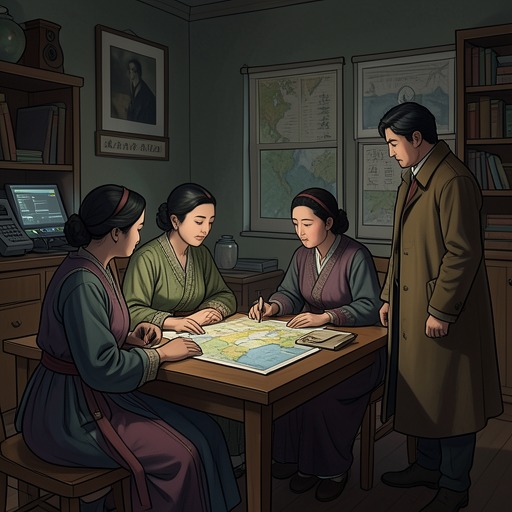
Women TalkingThe Map of the Americas is both a practical resource for the women’s planned departure from Molotschna and a measure of the gap between possessing a map and being able to use it. August Epp secretly obtains it with other supplies, conceals it among ordinary objects in Greta Loewen’s buggy, and tries to make its symbols intelligible to the women. Their exchange turns a tool of navigation into a question of who can read, explain, and direct the route ahead.
Acquisition and Concealment
August reports that, since the women’s previous meeting, he has procured the co-op safe, dynamite, and a world map. He has also obtained a sextant, though he doubts whether it will be useful. The map is part of a broader set of provisions assembled for the departure, not an isolated curiosity: it is gathered alongside equipment and food intended to help the group leave.
The objects are distributed through Greta’s buggy. August wraps the map around a large block of cheese and covers it with ordinary brown paper; he places it in the hatbox at the front of the buggy, together with the dynamite. The safe, by contrast, is stowed beneath the back seat. Onions, soap, and pieces of wood are packed as well, the wood available either to improve traction if the wheels sink into mud or to kindle a fire. This practical inventory gives the map a place within a material plan whose success depends on concealment, transport, and provisions as much as on choosing a destination.
The map’s presence also increases the risk to August. Ona warns that Klaas knows he has been with the women in the loft, supposedly learning to sew, and that his connection to the missing women and safe could make him appear to be the instigator. The map is not singled out as the cause of that danger, but it belongs to the preparations that could expose his participation. August accepts the possibility of blame rather than treating his own safety or standing in the colony as decisive.
A Map the Women Cannot Read
When Salome changes the subject to the map, she points out the immediate obstacle: the women cannot read it. Neitje responds by naming the cardinal directions—north, east, west, and south. Agata smiles and moves approvingly from side to side, while the other women purse their lips and shake their heads. The small lesson does not yet provide a route, but it introduces basic orientation into a conversation in which the map itself is present and still inaccessible.
August says that he has made a legend for the map. He explains that asterisks on it correspond to pictures in the legend, then identifies the kinds of features those pictures represent: rivers, roads both large and small, towns and cities, borders, and train tracks. The explanation supplies a key to the map’s signs, but the women’s silence after his first account shows that merely announcing a legend does not make the system transparent. The map’s usefulness depends on translation into shared knowledge.
When Mariche asks what the pictures show, August calls the map a map of the Americas. His earlier phrase about a celestial sphere confuses rather than clarifies: Mariche takes it to mean a map of the heavens and challenges the mismatch. Their exchange exposes the distance between technical or figurative language and the concrete information the women need. The map describes a region on Earth; its grand-sounding description does not tell them where to go. Ona asks what direction August thinks they should take, bringing the discussion back from naming the map to the decision it is meant to serve.
Reading, Authority, and Departure
The scene makes the map’s limits as clear as its potential. It can represent rivers, roads, settlements, borders, and rail lines, but it cannot choose among them for the women. Nor does the passage establish a final direction or show the women using the map to complete a route. The object enters the meeting as a possible aid to departure, while the question of how to interpret it remains active.
Knowledge is distributed unevenly around it. August has obtained the map and supplies, created the legend, and initially explains the symbols. Neitje contributes the cardinal directions; Ona draws attention to the need to decide a direction; Mariche tests August’s explanation and refuses to let ambiguous terminology pass as useful instruction. When Ona offers to help Mariche later, she opens the prospect of the women learning together rather than leaving the map’s interpretation entirely with August. That offer is not yet a completed lesson, but it shifts the scene toward shared access.
The map therefore stands at the intersection of practical escape planning and the colony’s restrictions on women’s knowledge. Its geography is broad, but the immediate problem is not simply distance: the women need a way to turn unfamiliar marks into choices they can make. Concealed with cheese and carried among ordinary goods, it is at once a secret object and an unfinished instrument of orientation. Its decisive significance lies not in a destination already chosen, but in the work of making the world it depicts readable to those preparing to leave.