The Bottom
HarvestThe Bottom is the village’s marshy low ground, valued not for its beauty alone but for the work and waste it absorbs. Called Turd and Turf in local speech and briefly renamed the Blossom Marsh during a mapping expedition, it gathers the practical knowledge of people who live by the land while becoming part of a mapped estate whose future may exclude them.
Ground and Uses
The Bottom lies below the brook, in a dank depression that drains into its own wet turf. The villagers use it as a charnel place for carcasses and skeletons, including animals too sick in death to eat, and as an open privy. Some prefer this to the closed wooden latrines near the dwellings: the marsh takes away the smell, whereas the latrines retain it until the village’s rotating gong farmer removes the waste. The narrator’s dry observation that a smell cannot be shoveled up makes clear how closely the place’s identity is bound to bodily labor and the management of refuse.
The marsh is also useful ground for gathering materials. Rushes are collected for lights, ferns for litter, clay for bricks, and peat and turves for winter fuel and roofs. Its unsightly functions and resources occupy the same terrain; what might look to an outsider like empty or degraded land is woven into ordinary survival. Its name Turd and Turf holds that combination without separating the foul from the useful.
The route into the marsh is overgrown and deliberately neglected. Ivy vines form a barrier that gives visitors privacy, while the path itself passes mud and wet turf. In one account, the ground is steaming where beech and oak no longer shade it, with sunbeams shaping the vapor beneath a flat blue sky. The distinctive view is not a pastoral blank: it includes a dome of cattle bones, pigs feeding on pannage, a swollen carcass, a sinking timber path used to carry turves, oily water at the deepest part of the quagmire, and coppiced goat-willows from which the villagers take sallow poles. Marsh, refuse ground, work site, and habitat are inseparable.
A Place Seen from the Path
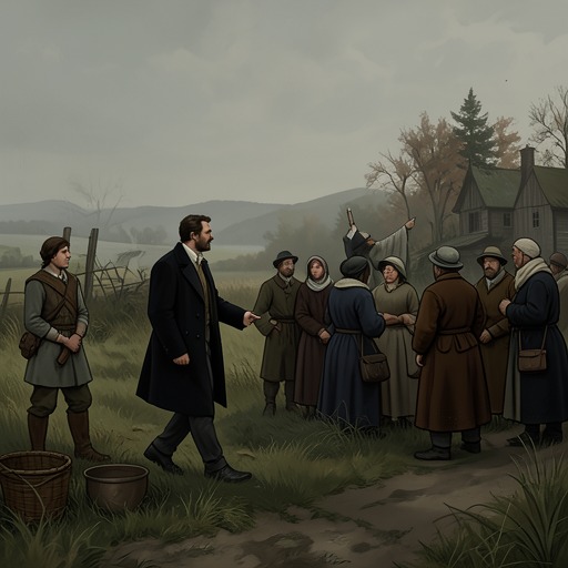
When Walter Thirsk guides Philip Earle through the village’s commons, he chooses The Bottom first, then plans to climb toward higher ground. He makes their approach noisy so that anyone already there will have warning. Although it is usually busy with tasks beyond the use of the privy, he expects the villagers to be away gleaning barley and working at the threshing floors. The excursion therefore brings Earle into a landscape whose uses are practical and seasonal, even when the guide and visitor temporarily have it to themselves.
Earle is delighted by the tour. The smell is worse than usual, but he mistakes it for the unaffected countryside; he does not remark on the bones or the flies. He calls the place peaceful, secluded, and humbling in its beauty, responding to the scene through a visitor’s aesthetic attention. Thirsk’s account holds that appreciation beside the mess and labor Earle overlooks. The contrast does not make the beauty false; it shows that beauty is only one way of seeing a place that must also be inhabited and worked.
When Earle asks for the marsh’s name, Thirsk initially resists giving it a more particular title. He says, “A marsh. A marsh. What should we call a marsh?” The answer expresses a practical habit of naming rather than a lack of knowledge: the village’s descriptions often identify what a place is for, who uses it, or what grows there. Earle proposes the Blossom Marsh, and Thirsk agrees that he should write it down. The new name gives the marsh a pleasing distinction for the map, while its older, blunter names retain the knowledge of its everyday functions.
Local Knowledge and Estate Maps
Earle’s visit is part of a larger survey commissioned by Charles Kent. On the village’s final day of harvesting, the villagers see the mapmaker recording their land with brushes and quills. His charts render fields, woods, cottages, ponds, and lanes as geometries and squares. Later, at a communal meal, Kent introduces Earle as the man he has employed to map the common ground and land, and says the charts will support petitions to the courts. The work is presented as an organization intended to benefit everyone, but the proposed future behind it is more troubling: the commons and fields are to be enclosed with walls, hedges, ditches, and gates, and the village’s agricultural life redirected toward wool.
Thirsk’s own way of identifying places is grounded in use and proximity. He offers names such as East Field and West Field, the Higgses’ goose pen, Hazel Wood, the Turbary, and the Warren. The village itself has no more elaborate title than The Village, and its surrounding land is simply The Land. These terms are not a measured survey, but they encode family claims, crops, and directions through familiar work. Against them, the official designation of the estate as the Jordan Estate or the Property of Edmund Jordan makes the land legible through ownership.
Walking with Earle also reveals what a map cannot easily preserve. The annual beating of the bounds follows routes that teach children where they belong: their heads are bumped against boundary stones, and they are made to taste the grass beneath them. Thirsk leads Earle through terrain whose elevation, mud, vegetation, and passages are known by movement. From the ground, distant fields may be separated by wooded ridges and difficult paths; on the page, they can sit side by side. Earle’s charts make the land comprehensible from above, but they do not reproduce the bodily journey through it.
Naming, Flattening, and a Threatened Future
Earle’s drawings are beautiful to Thirsk, but their beauty does not guarantee an honest account. The painted view flattens slopes and distances, removes the time a walk or task requires, and gives the land colors and patterns unlike the experience of crossing it. The proposed sheep-field chart is more tightly patterned still: its smaller, edged fields make the wood nearly disappear, and the robust human presence represented in the landscape loses its face. The map clarifies a scheme of division even as it suppresses parts of the life that scheme would change.
The Bottom matters within this tension because it resists easy conversion into a single kind of value. It is at once marsh, privy, charnel ground, source of materials, and a secluded landscape with birds, trees, water, and vapor. Earle’s name Blossom Marsh catches one aspect of its appearance; Turd and Turf preserves its material work. Neither name alone contains the place. As the estate’s survey turns common ground into lines and prospective fields, the marsh stands for what formal representation can record, beautify, or overlook—and for the local knowledge that a boundary on paper cannot replace.